


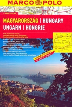
Autoatlas Maďarsko 1:300 000 (2009)
Vydavateľstvo: Marco Polo
| Bežná cena knihy: | 8,59 € |
|---|---|
| Naša cena: | 8,16 € |
| (zľava 5 %) |
posielame do 24 hodín
Informácie o knihe
This A4 sized road atlas covers Hungary at 1:300 000. The road and rail network is clearly laid out with subtle relief shading and heaps of spot heights showing the topography, intermediate road distances are shown on most roads. The atlas also marks out scenic routes and various places of interest such as campsites, hotels, motels, spas, recommended beaches and border crossings. The front cover is a fold out overview map showing the page references with a useful distance and travel time chart.
The back of the atlas has a handy 16 page road map of all of Europe at 1:4 500 000 which is great for route planning as it shows main towns, roads and ferry routes throughout Europe (including Iceland, the UK, most of Turkey and Russia as far as St. Petersburg and Moscow).
The atlas also includes 8 detailed city plans covering the major cities and towns. These show road names, hotels, hospitals, train stations and loads more useful or interesting buildings and landmarks.
A comprehensive index of place names is included which also lists postscodes. The legend is in 12 languages including English.
Zaradené v
Podrobnosti
- Počet strán: 96
- Formát: 220 × 295 mm
- Váha: 352 g
- Väzba: špirálová
- ISBN: 978-3-8297-3712-8
- Rok vydania: 2009
- Jazyk: anglický, francúzsky, nemecký, španielsky
- EAN: 9783829737128