


Istria, Pula 1:100 000 automapa (2012)
Vydavateľstvo: Freytag & Berndt
| Bežná cena knihy: | 9,99 € |
|---|---|
| Naša cena: | 9,49 € |
| (zľava 5 %) |
máme posledný kus, posielame do 24 hodín
Informácie o knihe
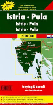
Map of Istria (Trieste area in Italy, Slovenian coast and north coast of Croatia) published by Freytag & Berndt. This detailed map of Istria includes the town map of Pula, Porec, Rovinj, Umag and Opatija. Notebook with the 10 major points of interest of Istria, photos, and a complete Index of cities. Multilingual legend.
Zaradené v
Podrobnosti
- Formát: 130 × 260 mm
- Väzba: skladaná mapa
- ISBN: 978-3-07-90764-3
- Rok vydania: 2012
- Jazyk: anglický, francúzsky, nemecký, španielsky, talianský
- EAN: 9783707907643